
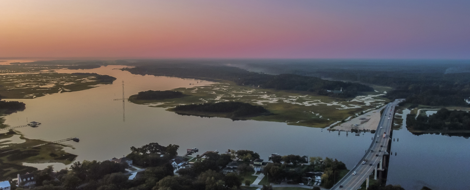
Johns Island, South Carolina, is the largest island in the state by land area, and like most of coastal Charleston County, portions of it are designated high-risk flood zones by the Federal Emergency Management Agency. What many buyers do not realize — and what can significantly affect the cost and complexity of a purchase — is that a meaningful portion of Johns Island lies entirely outside those high-risk designations.
Understanding the flood zones on Johns Island is one of the more practical steps a buyer can take before making an offer.

Pam Harrington Exclusives has been representing buyers and sellers on Johns Island since 1978. Flood zone considerations come up in nearly every transaction, and the specifics vary substantially from one parcel to the next.
This post explains how flood zones work, what they mean for insurance requirements and costs, and what steps every buyer should take before closing on a Johns Island property.
Quick Facts
Flood Zones on Johns Island
- Primary Flood Zones
- Zone X (low/moderate risk) and Zone AE (high risk, 100-year floodplain)
- Is Flood Insurance Required Everywhere?
- No. Required only in Zone AE (and Zone VE) for federally backed mortgages. Zone X carries no mandatory requirement.
- Typically Zone AE
- Properties adjacent to the Stono River, Kiawah River, and tidal creek corridors throughout the island
- Typically Zone X
- Elevated interior portions of the island, many established neighborhoods away from the creek edges
- Typical AE Insurance Cost
- $1,500–$4,500/year depending on elevation, structure, and coverage amount
- NFIP Coverage Maximum
- $250,000 for structure; $100,000 for contents — excess coverage available privately
- Key Tool for Buyers
- FEMA Flood Map Service Center — msc.fema.gov — free, searchable by address
- Elevation Certificate
- May already exist for the property. If so, request from the seller before closing.
Source: Pam Harrington Exclusives, Johns Island specialists since 1978.
Does Every Home on Johns Island Require Flood Insurance?
No. Flood insurance is not universally required on Johns Island, and this is one of the most common misconceptions buyers bring to the market. Whether flood insurance is required depends on two factors: the FEMA flood zone designation for the specific property and the type of mortgage financing used.
Flood insurance is mandatory for any property in a FEMA-designated Special Flood Hazard Area (SFHA) — specifically Zone AE or Zone VE — when the buyer is using a federally backed mortgage (FHA, VA, conventional loans backed by Fannie Mae or Freddie Mac).
Properties in Zone X — both unshaded (minimal risk) and shaded (moderate risk, also called the 500-year floodplain) — carry no mandatory flood insurance requirement under federal lending rules, though lenders have some discretion and buyers may still be advised to carry it voluntarily.

A significant portion of Johns Island's residential land lies in Zone X, a material advantage over some other Charleston-area submarkets.
That said, the island's creek corridors, riverfront parcels, and low-lying areas are predominantly Zone AE, and buyers targeting waterfront properties or creek-adjacent lots should budget flood insurance as a firm cost of ownership.
What Flood Zones Exist on Johns Island?
FEMA designates flood zones on Flood Insurance Rate Maps (FIRMs), which are updated periodically as topographic data and development patterns change.

On Johns Island, buyers will most commonly encounter the following designations:
-
Zone X (Unshaded)
Minimal flood risk. Outside the 100-year and 500-year floodplain. No mandatory flood insurance for federally backed mortgages. This is the designation most interior residential parcels on Johns Island carry.
-
Zone X (Shaded)
Moderate flood risk. Falls within the 500-year floodplain but outside the 100-year floodplain. No mandatory insurance, but voluntary coverage is worth considering.
-
Zone AE
High flood risk. Within the 100-year floodplain, meaning there is a 1% annual chance of flooding, which translates to a 26% chance of flooding over the life of a 30-year mortgage. Flood insurance is mandatory with a federally backed mortgage. Base Flood Elevations (BFEs) are established for these zones, which determine how a property is rated for insurance purposes.
-
Zone VE
The highest designation, applied to ocean-facing properties subject to wave action, is not a common designation on Johns Island itself, though it applies to portions of Kiawah Island and Folly Beach.
Which Parts of Johns Island Are Typically Zone X vs. Zone AE?
Flood zone boundaries on Johns Island follow the island's waterways and topography.
As a general pattern, properties adjacent to the Stono River (which borders the northern and western edge of the island), the Kiawah River (which runs along the southern edge toward Kiawah Island), and the island's numerous tidal creek systems are most likely to fall in Zone AE.
Interior residential neighborhoods set back from creek corridors and sitting on higher ground tend to sit in Zone X.

This matters practically because Johns Island has a diverse mix of community types — from creek-adjacent waterfront estates to interior master-planned neighborhoods on elevated pads.
Two homes in the same general area can carry different flood zone designations depending on the specific parcel's elevation and proximity to water. Zone boundaries do not follow neighborhood lines; they follow terrain.
Buyers should not assume that a community's general reputation — or even a neighbor's flood zone — applies to the specific property they are considering. The only reliable way to confirm a property's flood zone is to look it up by address in FEMA's Flood Map Service Center at msc.fema.gov, or to have a local agent who knows the area pull the designation as part of early due diligence.
Cortney Franklin, Pam Harrington Exclusives' Johns Island Specialist, verifies the flood zone for every property discussed with clients. In a market where parcel-level variation is this significant, neighborhood-level generalizations are not adequate for purchase decisions.
What Does Flood Zone Mean for Insurance Costs?
For properties in Zone X, flood insurance is optional. Voluntary Zone X policies through the National Flood Insurance Program (NFIP) typically cost $400–$800 per year, depending on the coverage amount. Some buyers in Zone X elect to carry them, given that approximately 25% of NFIP claims nationally come from properties in low- to moderate-risk areas.
For properties in Zone AE, costs depend heavily on the specific property's elevation relative to the Base Flood Elevation established for that zone. A home built well above the BFE will carry meaningfully lower premiums than one built at or below it. In coastal South Carolina, NFIP premiums for high-risk zone properties typically range from $1,500 to $4,500 per year for $250,000 in building coverage, though properties with significant elevation above BFE can sometimes fall below this range.
FEMA's Risk Rating 2.0 pricing methodology, implemented in 2021–2022, overhauled how premiums are calculated. Rather than relying primarily on flood zone maps, the new system considers individual property characteristics, including distance to water, structure type, replacement cost, and the property's elevation. The result is that two homes in the same Zone AE designation can carry very different premiums. An elevation certificate, if it shows the home is elevated above BFE, can significantly reduce premiums.
The NFIP caps coverage at $250,000 for the structure and $100,000 for contents. For higher-value Johns Island properties, particularly waterfront homes and new construction in communities like Kiawah River, buyers should explore excess flood coverage through the private market, which can provide limits beyond NFIP maximums.
What Is an Elevation Certificate and Do You Need One?
An Elevation Certificate (EC) is a document completed by a licensed surveyor or engineer that records the specific elevation of a property's lowest floor relative to the Base Flood Elevation for its zone. For properties in Zone AE, an elevation certificate is a critical tool for getting accurate insurance quotes and, in many cases, for reducing premiums.
Many Johns Island properties — particularly those in established neighborhoods and newer construction — already have elevation certificates on file. Buyers should ask whether an existing elevation certificate is available before ordering a new one, which typically costs between $300 and $600. If the current owner has one, it can often be transferred to the buyer and used for insurance quoting purposes.
An elevation certificate is not legally required to purchase flood insurance, but without one, insurers will price the policy at their least favorable rate for the zone. A property that sits two or three feet above BFE may qualify for substantially lower premiums once the elevation is documented. For any property in Zone AE on Johns Island, getting a quote with and without an elevation certificate is worth the effort.
Can You Transfer a Flood Insurance Policy When You Buy?
Whether an existing flood insurance policy can be transferred to a new buyer depends on several factors — it is not automatic, and the answer is not the same for every policy or every transaction.
For policies issued through the National Flood Insurance Program, transfer is generally possible. NFIP policies are tied to the property rather than the owner, and the Standard Flood Insurance Policy allows written assignment of building coverage to a buyer at closing. When a transfer is completed properly, the buyer steps into the existing policy without a coverage gap and without the 30-day waiting period that applies to new NFIP policies. If the seller established their policy before FEMA's Risk Rating 2.0 pricing took effect in October 2021, assuming it may also preserve a lower rate than a buyer would receive on a brand-new policy, making it worth asking about early in the transaction, not after closing.
For private flood insurance policies, transferability varies by carrier and policy terms. Some private insurers permit assignment to a new buyer under the same conditions as NFIP; others do not. There is no uniform rule. Buyers should not assume a private policy transfers, and sellers should not assume it does not — the specific policy language and the insurer's procedures govern.
Regardless of policy type, several conditions must be met for any transfer to proceed smoothly. The policy must be active and in good standing, with all premiums current, at the time of transfer. Proper documentation is required from both parties — the seller provides proof of the existing policy, and the buyer provides proof of purchase. Lenders may have their own requirements about coverage levels for the transferred policy, so confirming lender approval before closing is important. If the property's flood zone designation has changed recently, that reclassification may affect the terms under which the policy transfers or the premium that applies.
Timing matters as well. The transfer process should be initiated well before the closing date to avoid any lapse in coverage. Buyers should raise the question of the seller's existing flood insurance policy during the offer stage — not after closing — so the policy type, transferability, current rate, and any lender requirements can all be evaluated as part of the purchase decision.
How to Check the Flood Zone for Any Johns Island Property
Every buyer considering a property on Johns Island should take the following steps before making an offer:
- Look up the specific address in FEMA's Flood Map Service Center at msc.fema.gov. This is free and returns the official flood zone designation for the parcel.
- Ask whether an existing elevation certificate is on file. If yes, request a copy. If no, budget $300–$600 for a new one if the property is in Zone AE.
- Get a flood insurance quote before closing — not after. Your insurance agent can quote both NFIP and private flood options using the elevation certificate if available.
- Ask about the seller's existing flood insurance policy. If it is an NFIP policy, confirm whether it can be assigned to you at closing.
- Check the property's flood claim history. FEMA tracks National Flood Insurance Program claims by property address, and a history of repeated claims is material to a purchase decision.
The flood zone is one piece of a broader due diligence picture on Johns Island. For a full overview of what buyers should know before purchasing in this market, our Johns Island buyer and seller guide covers the process in detail.
Ready to explore what Johns Island has to offer? Browse all Johns Island listings to see what is currently available across the island's communities, waterfront options, and price points.
About Pam Harrington Exclusives
Pam Harrington Exclusives is an independent luxury real estate brokerage founded in 1978, specializing in Johns Island, Kiawah Island, and Seabrook Island, South Carolina. The firm's offices are located at 4341 Betsy Kerrison Parkway on Johns Island — the primary corridor serving the island's waterfront communities.
PHE has completed over $2 billion in cumulative sales and operates as an MLS-affiliated, women-owned company. Phone: 843.768.3635.